Posts

Silver Reef

Image
Saturday , February 12, 2022  Hike #16 of 2022.  5.5 miles / 71.0 miles YTD This was another one in the Red Cliffs area, which we just love. It was a beautiful 70° and it was so nice to be able to wear shorts (hiking pants just are not comfortable)! We only saw a few other people on the trail, which was surprising considering the weather. But, we do try to pick more remote / less popular trails on purpose. This trail had quite a bit of gradual incline and a lot of rocks to step over/around, but nothing too difficult. As always, there was lots of sand and we did find one big hill for Summit to run (she just LOVES it!). She was incredibly well behaved and we are very pleased with how patient she is with us when we do stop to take in the views, look at something along the trail, check the map on AllTrails, etc.

Dino Cliffs Trail

Image
Monday, February 7, 2022  Hike #15 of 2022.  5.0 miles / 65.5 miles YTD This trail has dinosaur tracks but we did not come across them. I Googled it after the fact (which we should have done before going) and it sounds like they were actually very close to the start of the trail. I have an idea of where they were based on the description, so we'll have to go back again. ( Note that we went back on March 6 and found them. They were where I thought they'd be, based on what I found on Google. And there were some really big ones! If we had known where to be looking for them originally, we never would have missed them.) We started out on the trail (which is actually a very short trail; although, it connects up with others), but then we climbed up to go out on a ledge and then ended up just exploring around the top of what you can see in the third photo below, until we found a place that we could get back down with Summit. She really is very brave and adventurous but there wer

More Cowbell Trail

Image
Sunday, February 6, 2022  Hike #14 of 2022.  3.5 miles / 60.5 miles YTD This was another mountain bike trail that was really quite easy for hiking - it was really just going for a walk. Mountain biking isn't something we have ever done but we are interested in doing it. There are trails around here that I would be way too scared to ride on but this one would be a really good beginner trail. There were a few different trails that branched off from this one and, if I had to guess, were probably more difficult. This one was a nice casual hike with some great views. We only saw a handful of bikes on the trail, which would also be a benefit if learning to trail ride. This was the "More Cowbell Trail", complete with a cowbell at the end that Summit rang.

Gila Trail - Snow Canyon

Image
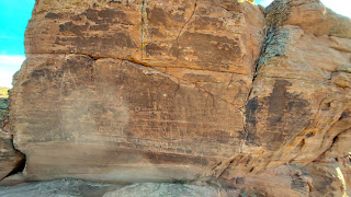
Saturday, February 5, 2022  Hike #13 of 2022.  5.0 miles / 57.0 miles YTD This trail is technically part of Snow Canyon State Park but it can be accessed from outside the park (by parking along the highway). AllTrails led us to a trailhead that was actually private property but the landowners were nice enough to not just have a "private property, no trespassing" sign but actually had a legitimate sign made (not just a piece of paper) providing directions for how to access the trail properly (by parking on the side of the highway). Our goal on this one was to see some petroglyphs. However, there was a very large family with some loud and rowdy kids in the area when we got to it so we decided to take the trail the long way around and see the petroglyphs at the end. Well, we ended up getting off track some (even with the help of AllTrails) and the petroglyphs ended up being rather hard to get to in some places, especially with Summit. We had already gotten a late start on th

Kentucky Lucky Chicken Trail

Image
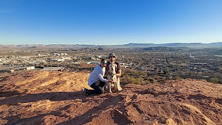
Monday, January 31, 2022  Hike #12 of 2022.  6.0 miles / 52.0 miles YTD I used some PTO again this afternoon since Dan is off on Mondays. We are so fortunate to have so many amazing trails in such close proximity to where we live! This is another one that we did not even have to leave the city limits to get to. We did have to walk the paved pedestrian trail a little while before getting to the hiking trail though. The trail is called the Kentucky Lucky Chicken Trail (I would be interested to know how it got the name). It is a loop and another mountain bike trail. We went up the shortest/steepest way and then took the long gradual decline down. It is always interesting to look down on the city and get a broad perspective of where things are in relation to each other (especially now that we are more familiar with the area and have been on trails in a lot of different areas surrounding the city). We could not actually see our apartment building because it was down over the other si

Pine Valley

Image
Saturday, January 29, 2022  Hike #11 of 2022.  7.0 miles / 46.0 miles YTD We sought out the snow today and headed up to Pine Valley!  We spent so many hours camping and hiking in Pine Valley from March-October 2021 but haven't been back since.  It felt so good to be back in the place that is the most like "home" to us here in Utah now. Pine Valley is always a good 20* cooler than the St. George area.  That is why we spent so much time hiking and camping here last summer.  So we were expecting it to be quite chilly but it was near 50* so it really wasn't bad at all...until the sun started to go down.  Then it got chilly fast.  But we were smart enough to bring appropriate layers along this time.  Although, we honestly had thought we'd need them the entire time but really didn't until near the end of the hike. We had already found out on Thanksgiving Day that Summit loves running in sand.  Well, today we found the same to be true of snow (although the snow was m

T-Bone Trail

Image
Monday, January 24, 2022  Hike #10 of 2022.  4.5 miles / 39.0 miles YTD Today's hike was right on the very edge of town on the T-Bone trail.  There is a parking area at each end of this trail so you can approach it from either direction.  We have done a small portion of the trail - starting from the end closest to the city - a couple of times.  Once was on a vacation out here a number of years ago and the second was not long after we moved here.  Both of those times, we turned off the T-Bone trail and continued on down a different trail.  This time, we parked at the end that is farther outside of town and hiked in from the opposite direction.  For the most part, this is just another OHV trail.  So I honestly was expecting it to be rather boring.  It is fairly straight and it goes through a wide open area so the majority of the views are far off in the distance, until you reach Pioneer Park on the edge of the city.  However, even though it is fairly straight, there is quite a bit of